Craftfineart.com
Search
it
Oblíbené položky
Košík
È SPUNTATO IL NOSTRO SCONTO
ESTIVO, USA IL CODICE sale10
×
Le nostre proposte di design:
semplicità
eleganza
moderno
vintage
classico


Cina

ID: #4310 | Barocco | Architettura

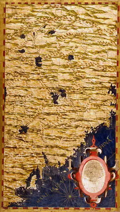
L'immagine mostra una vecchia carta geografica che illustra una parte del mondo con i contorni delle terre emerse e delle isole. Mostra vari dettagli geografici come le catene montuose e le rotte marittime. In basso è presente un elemento decorativo di rilievo con una casella di testo che probabilmente contiene una descrizione o una spiegazione della mappa. La mappa è realizzata in tonalità martellate oro e marrone con elementi blu e rossi, che le conferiscono un aspetto storico.
Creata dall'intelligenza artificiale, si prega di essere indulgenti.

Prevailing color of this fine art print is giallo and its shape is ritratto. This image is printed on demand - you can choose material, size and finishing.

Egnazio Danti (1536-1586) Born to a wealthy family in Italy. He learned the basics of painting from his father, and later his aunt developed his talent. In 1555, he joined the Dominicans, where he devoted himself to not only philosophy and theology, but also to mathematics, astronomy and geography. As a scholar, he devoted himself to painting maps and map works. For four years, he also participated in the work on the large Guardaroba Globe. He also devoted himself to architecture. For example, he provided plans to build a church and monastery in Bosco Marengo in Piedmont. He designed an architectural element that allowed a narrow beam of light to enter the church at noon.

Motif size

Total size: 45 x 80 cm

Material


Finishing


Frame & passepartout

colour of passepartout
none

Selected finishing

Matte paper (print)
Share this settingShare this setting
Print. The image is printed on the top quality 9-ink HP Z9PS printer on Fomei Cotton Smoooth g / m2 paper. You can choose any size to an accuracy of 1 cm. A margin of 5 cm around the image is added to the size of the motif.

ZoomZoom

You can find a detailed description about our finishings here.

:
35 €

Shipping date: 2 days

Cina

ID: #4310 | Barocco | Architettura

L'immagine mostra una vecchia carta geografica che illustra una parte del mondo con i contorni delle terre emerse e delle isole. Mostra vari dettagli geografici come le catene montuose e le rotte marittime. In basso è presente un elemento decorativo di rilievo con una casella di testo che probabilmente contiene una descrizione o una spiegazione della mappa. La mappa è realizzata in tonalità martellate oro e marrone con elementi blu e rossi, che le conferiscono un aspetto storico.
Creata dall'intelligenza artificiale, si prega di essere indulgenti.

Prevailing color of this fine art print is giallo and its shape is ritratto. This image is printed on demand - you can choose material, size and finishing.

Egnazio Danti (1536-1586) Born to a wealthy family in Italy. He learned the basics of painting from his father, and later his aunt developed his talent. In 1555, he joined the Dominicans, where he devoted himself to not only philosophy and theology, but also to mathematics, astronomy and geography. As a scholar, he devoted himself to painting maps and map works. For four years, he also participated in the work on the large Guardaroba Globe. He also devoted himself to architecture. For example, he provided plans to build a church and monastery in Bosco Marengo in Piedmont. He designed an architectural element that allowed a narrow beam of light to enter the church at noon.


How do we make our pictures (detailed view)

Our reviews from Trustpilot.com

Trusted by our customers. Our customers have been satisfied with us for a long time. We appreciate it and thank you for your trust. You can find more reviews and details of our service ratings on Trustpilot.com.


You might like


45 x 80 cm
35 €